Services
Survey services, specified like an engineer would.
Every service below includes what it costs, what it finds and what you actually receive. If something is not suitable for a drone, we will tell you before you spend anything.
01 · Thermal imaging
Thermal Imaging Surveys
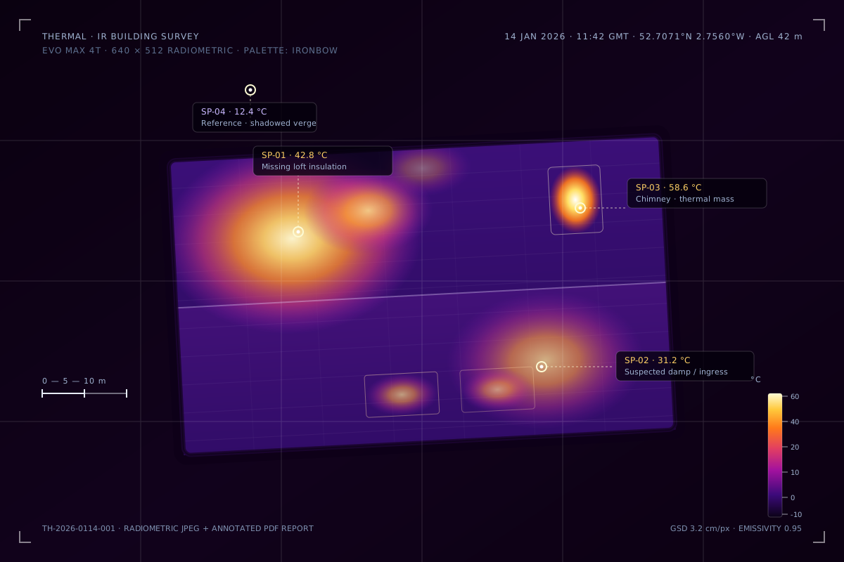
Aerial thermal imaging uses a radiometric sensor to measure surface temperatures and detect anomalies invisible to the naked eye. We fly the Autel EVO Max 4T with its 640 × 512 uncooled VOx microbolometer, giving temperature measurement accuracy of ±2 °C or ±2% (whichever is greater) across a range of −20 °C to 550 °C. Every pixel in a radiometric image carries a temperature value, so you get measurements, not just colours.
What it finds
- Heat loss through roofs, walls and windows
- Moisture ingress and damp
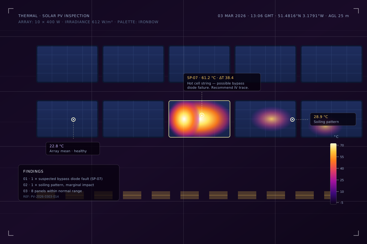
- Electrical hotspots in solar PV arrays and distribution boards
- Insulation defects and thermal bridging
- Flat roof membrane failures
Deliverables
- Radiometric JPEG images (temperature data in every pixel)
- Annotated PDF report with spot temperature readings
- Optional thermal orthomosaic map with GPS overlay
- Typical price
- £300–£750
- depending on site size and reporting depth
- Typical clients
- Building surveyors, property managers, solar O&M contractors, facilities management companies

02 · Mapping & photogrammetry
Aerial Mapping and Photogrammetry
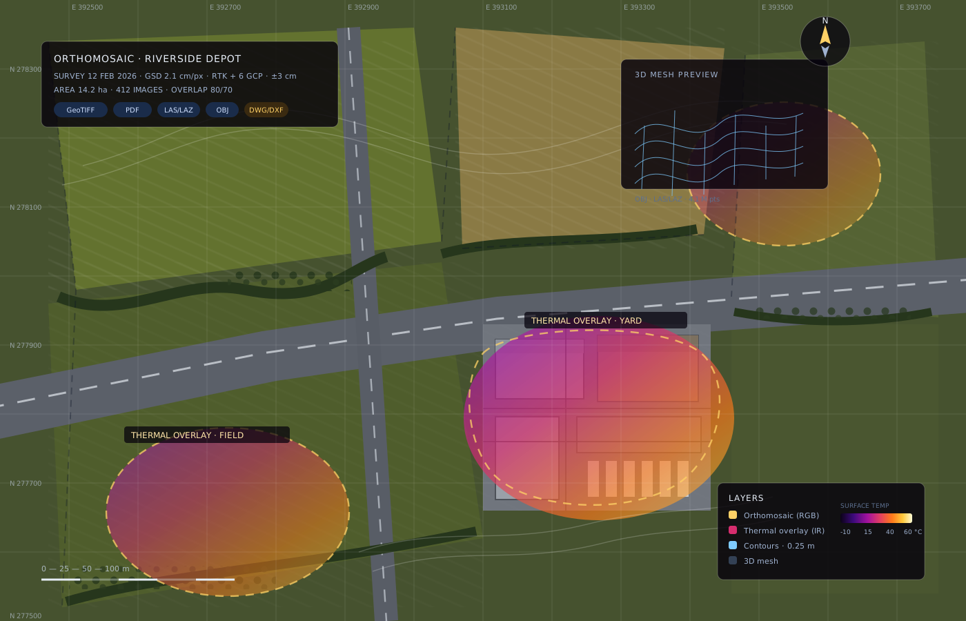
We fly a programmed grid pattern and capture hundreds of overlapping high-resolution images, which are processed into orthomosaic maps, digital surface models and 3D point clouds. Ground control points and the EVO Max 4T's laser rangefinder keep outputs accurately georeferenced, and every deliverable can be opened in standard GIS and CAD software.
What it finds
- 2D orthomosaic maps (GeoTIFF and PDF)
- 3D models (OBJ, LAS/LAZ point clouds)
- Volumetric calculations (stockpiles, excavation)
- Elevation and contour maps
- Progress tracking with repeatable flight plans
Deliverables
- Georeferenced orthomosaic (GeoTIFF + PDF)
- Point cloud and 3D mesh (LAS/LAZ, OBJ)
- Volumetric or contour summary report
- CAD-ready outputs on request (DWG/DXF)
- Typical price
- £350–£950
- depending on area and processing requirements
- Typical clients
- Land surveyors, construction firms, planning consultants, agricultural land managers

03 · Roof & building inspections
Roof and Building Inspections
We inspect roofs, facades, gutters and chimneys using both drones. The DJI Mini 4K (249 g) handles lightweight, low-risk visual capture and confined spaces, while the EVO Max 4T covers thermal and zoomed inspection of larger assets. You get the same detail as a scaffold survey at a fraction of the cost — and nobody leaves the ground.
What it finds
- Missing or damaged roof tiles and slates
- Flat roof membrane condition
- Gutter blockages and damage
- Chimney stack condition
- Facade cracks and spalling
- Thermal anomalies associated with damp or insulation failure
Deliverables
- High-resolution 4K images, catalogue-referenced
- Annotated PDF report with defects highlighted
- Thermal imagery where relevant
- Priority/action summary for maintenance planning
- Typical price
- £175–£450
- residential · from £300 commercial
- Typical clients
- Homeowners, landlords, property management companies, housing associations
Good to know
Questions we get asked before every booking.
Anything else, just ask. We would rather answer a question now than fix a misunderstanding later.
Ask us something- What happens if a drone is not the right tool?
- We will tell you. If scaffolding, a ladder survey or a handheld thermal camera would do the job better or cheaper, we say so — and point you to someone who can help if we cannot.
- How long does it take to receive the data?
- Most outputs are delivered within one to five working days, depending on the survey type and processing depth.
- Do you sort permissions and airspace?
- Yes. We check airspace restrictions, NOTAMs and site permissions as part of survey planning. We are CAA-registered and carry commercial public liability cover.
- Can you fly in wind or rain?
- The EVO Max 4T is IP43 rated with 12 m/s wind resistance and can fly in light rain. If conditions are unsafe we reschedule at no cost rather than fly marginal conditions.
- Who owns the data?
- You do. We retain copies only as long as needed for quality checks and legal records, and never share site data without written permission.
Not sure which service fits?
Describe the problem — not the technology. We will recommend the right approach, even if that means fewer flight hours for us.